Industry
- use case -
- Other
- Public institution
- Agriculture, forestry, fishery
- Natural resources and energy
- Transport and telecom
- Construction, real estate
- Insurance, finance, media
- Environment
- Natural disaster
- Other industries
Information
-

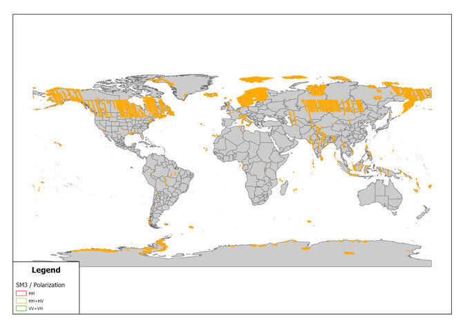
ALOS-2 Archived Images
SM3 Mode Archived Images Observed in June 2023
ALOS-2 observations are mainly based on the Basic Observation Scenario. In order to promote to make …
-
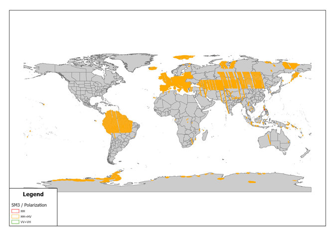
ALOS-2 Archived Images
SM3 Mode Archived Images Observed in May 2023
ALOS-2 observations are mainly based on the Basic Observation Scenario. In order to promote to make …
-
ALOS-2 Archived Images
SM3 Mode Archived Images Observed in April 2023
ALOS-2 observations are mainly based on the Basic Observation Scenario. In order to promote to make …
-
ALOS-2 Archived Imageries
Turkey-Syria Earthquake in February 2023 - ALOS-2 datasets for InSAR analysis
ALOS-2 acquires imageries according to JAXA's basic observation plan. However, in the event of a nat…
-
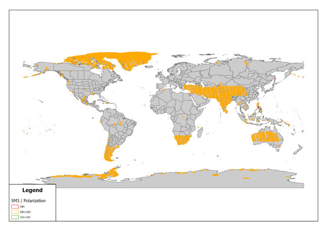
ALOS-2 Archived Images
SM3 Mode Archived Images Observed in March 2023
ALOS-2 observations are mainly based on the Basic Observation Scenario. In order to promote to make …