
- Other
- Natural disaster
- Other information
Volcanic eruption
What you can see from Satellite Image[Eruption of Submarine Volvcano]
Submarine volcanic activity near South Iwo Jima
On August 13, 2021, an eruption was confirmed for the first time in 11 years since February 2010 (Fig. 1)* at the submarine volcano "Fukutoku Okanoba" in the south of Iwo Jima and north of South Iwo Jima in the Ogasawara Islands.
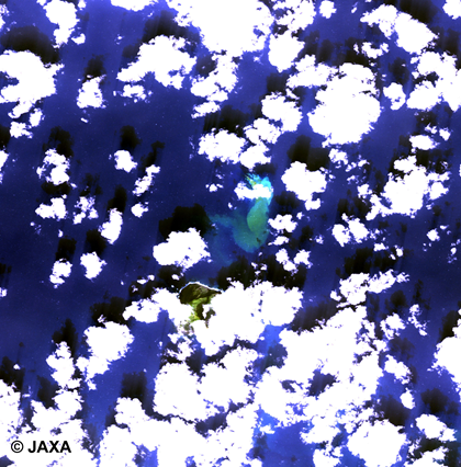
Figure 1. Image taken by ALOS AVNIR2 on February 7, 2010*
After the eruption 11 years ago, it was submerged and became a Guyot** with a shallowest water depth of about 25 m. However, an eruption of a submarine volcano was confirmed on August 13.
Fukutoku Okanoba
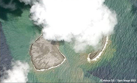
Figure 2 shows an image of the SPOT satellite taken near Fukutoku-Okanoba. Clouds look white. You can see the yellowish brown and milky white discolored water on the north side of South Iwo Jima.
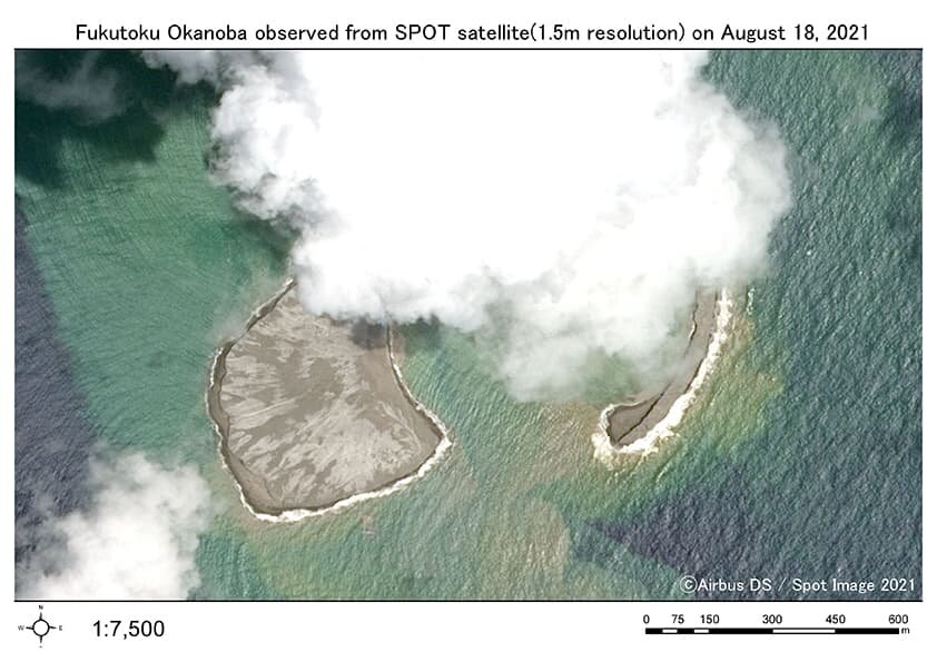
Figure 2. Fukutoku Okanoba taken with SPOT satellite*** (1.5m resolution; at 9:50 JST on August 18, 2021).
*Source:JAXA
https://www.eorc.jaxa.jp/ALOS/img_up/jdis_av2_fukutoku_100207.htm
**A guiyot is a seamount with a flat top.
***You can order from here!
https://www.satim.co.jp/satellite/spot/spot6-7/

