
- ALOS-2
- Natural disaster
- Other information
ALOS-2 Sample Data
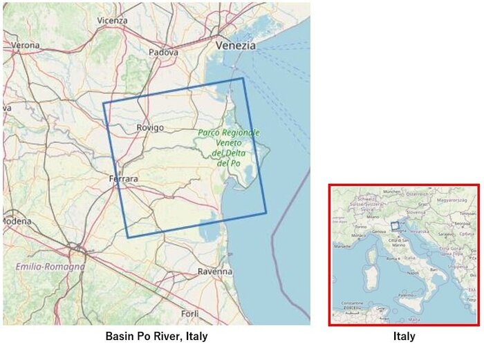
Historic drought impacting the Po River Basin in Northern Italy
Global warming increases the likelihood of drought, and even if scientists are still studying the connection between the unforgiving summer in the Po River basin and the broader phenomenon of climate change, dry periods of varying severity are becoming the new normal for farmers everywhere.
Climate change can also affect precipitation patterns around the world, making dry areas drier.
In nouthern Italy, there was less snowfall last winter and this spring was less rainfall in the region. And this summer brought the entire Europe with heat wave and higher temperatures made the Po River water level lower than usual and dried out soils and vegetation that affected water availability for agriculture.
We have created composite images of two spectral bands; for the observation of 2021 in "Red" and 'Blue" for 2022.
For the reference purpose, we did comparison of ALOS-2 composite image with Sentinel-2 optical satellite image and we were able to distinguish red areas where crops had good growth and blue areas indicated poor crop growth.
By focusing on the Po River, the blue color indicates that the river bed is visible because there is no water this year.
Change Analysis between 2 periods (Aug 2021 and Jul 2022)
PASCO conducted a simple analysis using images from two time periods. We picked up the images of the dried area of the Po River downstream captured ALOS-2 SAR satellite. One image was captured on August 4, 2021 (under normal condition) and the other one was captured on July 7, 2022 (affected by drought).
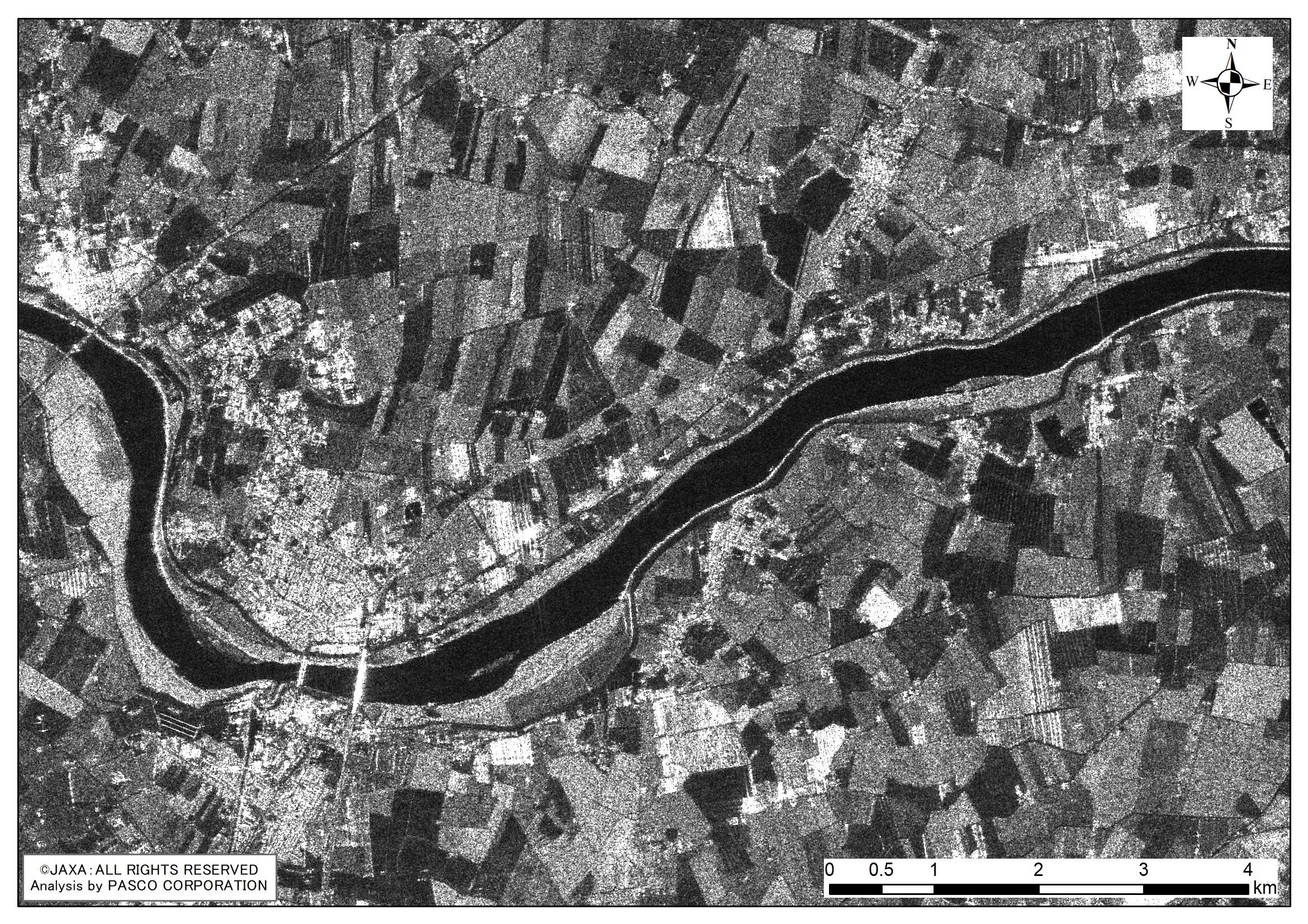
Scene ID : ALOS2388840890-210804 Observation Date : Aug 4, 2021
|
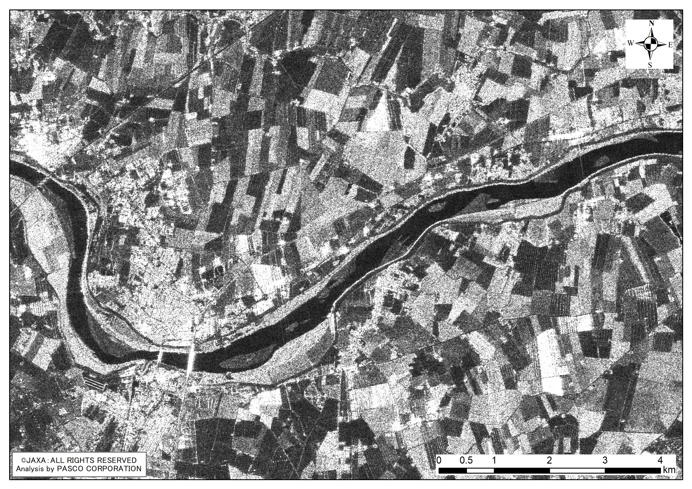
Scene ID : ALOS2438520890-220706 Observation Date : Jul 6, 2022
|
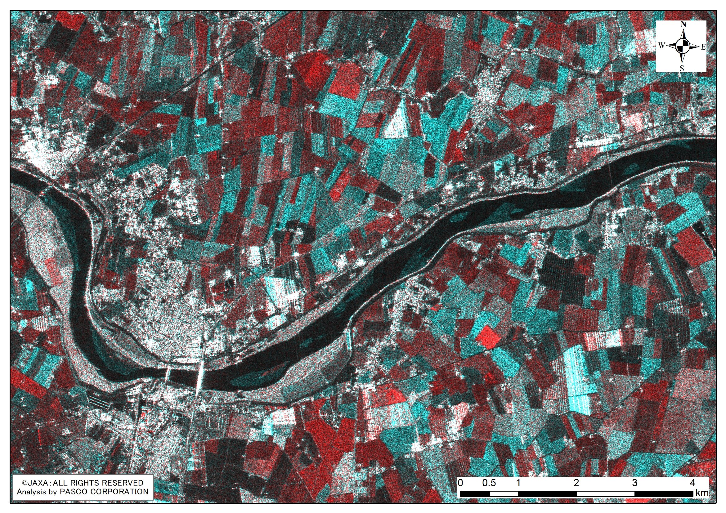
Color composite image of 2 acquisition periods
■ ALOS-2 imageries specifications
Observation mode:StripMap (SM3)
Resolution:10m
Polarization:HH+HV
Off nadir angle:32.5 degrees
Beam ID:F2-6
■ Product processing level and parameters
Level 2.1 (Orthorectified)
Orbit accuracy:Most accurate and available
Resampling:NN
Framing:Geo-coded
Map projection:UTM
Image format:GeoTiff
Pixel spacing:6.250m
Scene shift:0 (no shifting)
Reference:ALOS-2 Product Parameter Setting for Archived Data
If you are interested in the above imageries, we can provide them as samples, so please describe "【ALOS-2 Sample Data】Drought Basin the Po River, Italy" in the detail inquiry of “Contact us”.
Please also see the following pages for your information. - SM3 Mode Archived Images Observed in July 2022 - How to order archived data - ALOS-2 PriceList

