
- ALOS-2
- Environment
- Technical information
Time-series Interferometric SAR analysis
Availability of worldwide datasets for the time-series Interferometric SAR (InSAR) analysis
Extensive archives around the world
ALOS-2 has been observing the entire Earth periodically and a rich global archive of the images is available. By utilizing the archived images, time-series Interferometric SAR (InSAR) analysis can be conducted speedily, such as SBAS and PSInSAR that requires large stacks of SAR images.
Start a regular effective monitoring immediately by utilizing archived observed images!
The time-series InSAR analysis is a technique for monitoring and measuring the ground surface displacement by utilizing multiple time-series of SAR images. By using a large stacks of SAR images, the effect of noise such as atmospheric effects and DEM errors can be reduced, and the amount of ground displacement can be detected more accurately with InSAR analysis of only two observation periods. There are several methods for time-series InSAR analysis, such as SBAS and PSInSAR, which require more than 10 to 15 images. With archived images, there is no need for a period to accumulate images, and an effective regular monitoring can be performed immediately.
Status of the archived images
The following shows the regions where more than 10 archived images are accumulated with 10m resolution from 2014 to 2020. The images below show the number of archived images acquired at the same location in different colors for each number of times. The color is darker where the number of images is high.
※Please check the URL below for details of the observation plan and observation results.
https://www.eorc.jaxa.jp/ALOS/en/alos-2/a2_observation_e.htm
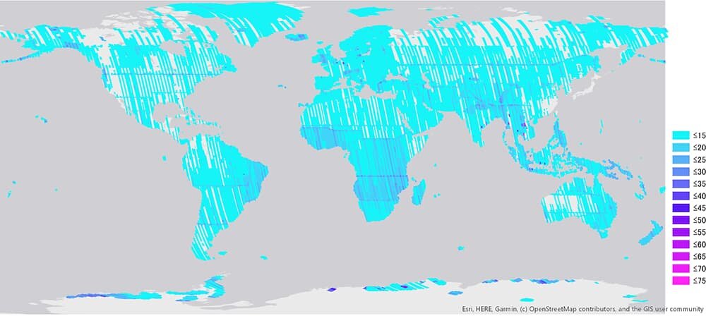 Stripmap (10m) ascending (northbound orbit)
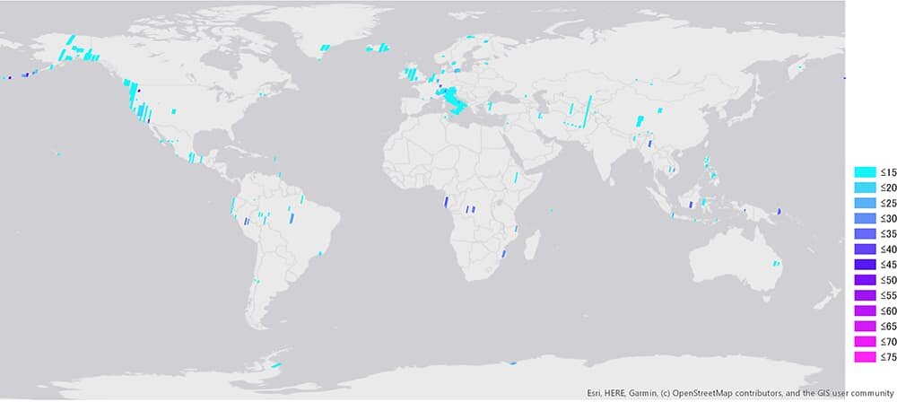 Stripmap (10m) descending (southbound orbit)

