- ALOS-4
- Other
- Other information
PALSAR-3/SM3 Footprint Data Available for Download
ALOS-4 Cumulative Archive Footprint Data Release (South America)
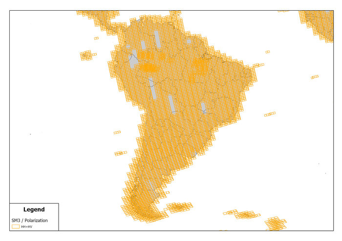
ALOS-4, which began its normal observation operations on April 1, 2025, has been accumulating earth observation data for over a year. This page provides the cumulative observation footprint of ALOS-4 acquired during the one-year period from April 1, 2025 to March 31, 2026. The footprint data from the ALOS-4/SM3 mode is organized by region and made available for download.
PALSAR-3, onboard ALOS-4, is an L-band SAR sensor capable of all-weather, day-and-night observations. It is widely used for applications such as forest monitoring, disaster assessment, and infrastructure monitoring. In South America, there is a growing need to utilize SAR data for purposes such as monitoring deforestation in the Amazon and detecting illegal development. The L-band PALSAR-3 has excellent vegetation penetration capabilities and can capture information that is difficult to obtain with optical satellites.
This page offers the following features: ・Comprehensive coverage of observed footprint data across South America ・Scene-based browsing ・Direct download of footprint data (Shapefile / CSV format)
We encourage you to explore observation coverage in your area of interest.

