
- ALOS-4
- Other
- Other information
PALSAR-3/SM3 Footprint Data Available for Download
ALOS-4 Cumulative Archive Footprint Data Release (North America)
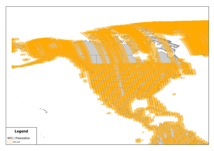
ALOS-4, which began its normal observation operations on April 1, 2025, has been accumulating earth observation data for over a year. This page provides the cumulative observation footprint of ALOS-4 acquired during the one-year period from April 1, 2025 to March 31, 2026. The footprint data from the ALOS-4/SM3 mode is organized by region and made available for download.
PALSAR-3, onboard ALOS-4, is an L-band SAR sensor capable of all-weather, day-and-night observations. It is widely used for applications such as forest monitoring, disaster assessment, and infrastructure monitoring. Particularly in North America, SAR data is becoming increasingly important for enabling rapid response to disasters such as earthquakes, wildfires, and floods.
This page offers the following features: ・Comprehensive coverage of observed footprint data across North America ・Scene-based browsing ・Direct download of footprint data (Shapefile / CSV format)
We encourage you to explore observation coverage in your area of interest.

