
- ALOS-4
- Natural disaster
- Other information
ALOS-4 data
InSAR Analysis of the December 2025 Earthquake off the east Coast of Aomori Prefecture Using ALOS‑4 Data
ALOS‑4 (Advanced Land Observing Satellite “DAICHI‑4”) transitioned to nominal observation operations after completing its initial calibration and validation phase, which lasted from its launch on July 1, 2024, through March 31, 2025. With the establishment of a high-frequency, high-precision observation capability enabled by L-band SAR, it is now possible to rapidly and accurately monitor natural phenomena such as earthquakes, volcanic activity, and ground deformation.
This article presents a case study of interferometric SAR (InSAR) analysis targeting the earthquake that occurred off the eastern coast of Aomori Prefecture in December 2025, using ALOS‑4 data. By comparing satellite data acquired before and after the earthquake, we reveal the spatial distribution and scale of surface displacement associated with the earthquake.InSAR Analysis – Earthquake off the east Coast of Aomori Prefecture
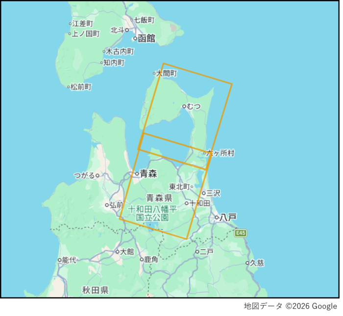
At approximately 23:15 (JST) on December 8, 2025, an earthquake occurred with its epicenter off the eastern coast of Aomori Prefecture. The earthquake had a magnitude of 7.5 and recorded a maximum seismic intensity of 6+ (JMA scale), with strong shaking observed across a wide area from the Tohoku region to Hokkaido. Following the event, the “Off the Coast of Hokkaido and Sanriku Subsequent Earthquake Advisory” was issued for the first time since the system was established, drawing significant public attention.
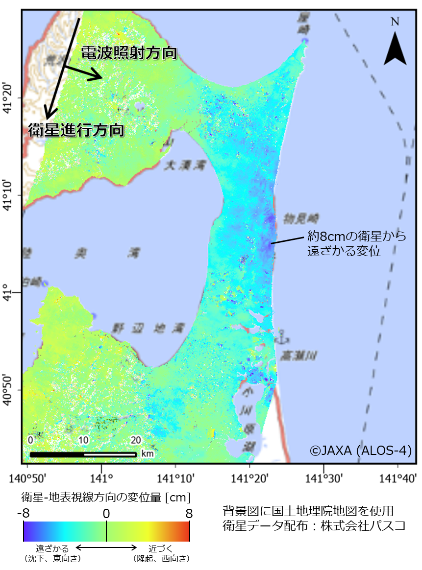
In this analysis, ALOS‑4 data acquired before and after the earthquake were used to perform interferometric SAR (InSAR) processing. InSAR is a technique that detects subtle ground deformation over a wide area by analyzing phase differences between SAR datasets observed at different times over the same region. This method is particularly effective for earthquake studies, as it can capture displacement on the order of a few centimeters over large areas. To improve the accuracy of the analysis, ionospheric delay effects—commonly observed in L-band SAR data—were mitigated using the Split-Spectrum Method (SSM). Furthermore, phase unwrapping processing was applied to derive continuous displacement in the satellite line-of-sight (LOS) direction from the phase differences.
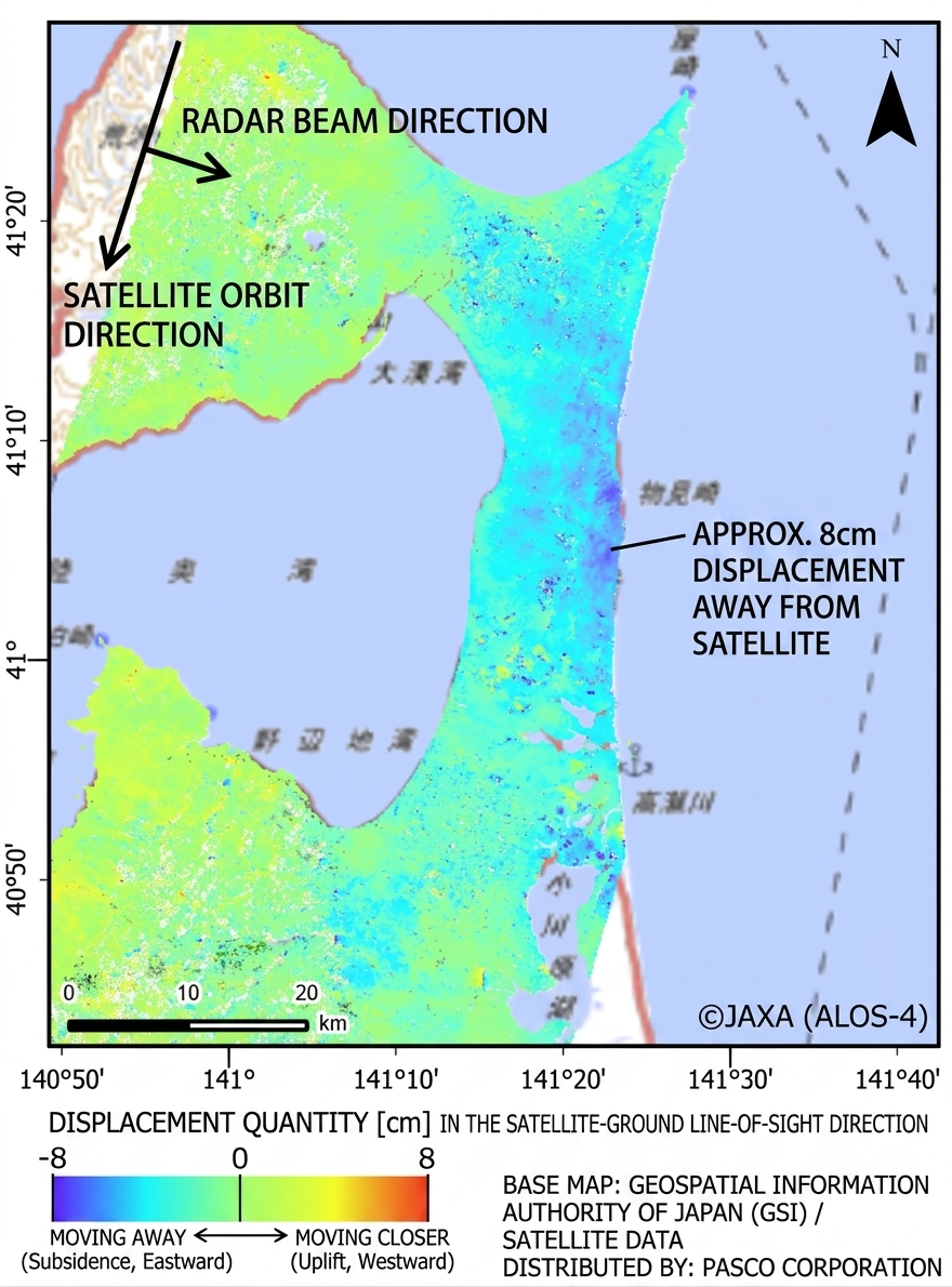
As a result, the post-event deformation distribution revealed displacement of up to approximately 8 cm near the base of the Shimokita Peninsula. The movement was observed in a direction away from the satellite (indicating subsidence or eastward displacement). This confirms that crustal deformation associated with the earthquake extended to onshore areas. These results demonstrate that ALOS‑4’s high-resolution and high-frequency observation capabilities enable rapid and effective assessment of post-earthquake conditions.
■ ALOS‑4 Observation Parameters Observation dates:November 16, 2025, and December 14, 2025 Observation mode:StripMap 3m (SM1) Spatial resolution:3m Polarization:HH+HV Orbit direction:Descending (southbound) Scene IDs:ALOS40242750251116UWDPLD0107、ALOS40242760251116UWDPLD0107 ALOS40242750251214UWDPLD0107、ALOS40242760251214UWDPLD0107

