

- ALOS-2
- Natural disaster
- Other information
ALOS-2 Analysis of the Kumamoto Earthquake
InSAR and Pixel Offset Analysis Results for the July 28, 2026 Kumamoto Earthquake
At approximately 16:27 (JST) on July 28, 2026, a magnitude 7.1 earthquake occurred at a depth of 16 km in the Kumamoto region of Kumamoto Prefecture, Japan. Seismic intensity 7 on the Japan Meteorological Agency (JMA) scale was observed in Uki City and Hikawa Town, Kumamoto Prefecture. Seismic intensities ranging from Upper 6 to 1 were recorded across a wide area extending from the Hokuriku region to Kyushu.
To assess the impacts of the earthquake, ALOS-2 ("DAICHI-2") conducted an emergency observation on the night of July 28. Using the post-earthquake image and a pre-earthquake image acquired in the previous year, InSAR (Interferometric Synthetic Aperture Radar) analysis and pixel offset analysis were performed by PASCO. The results are shown in the figures below.
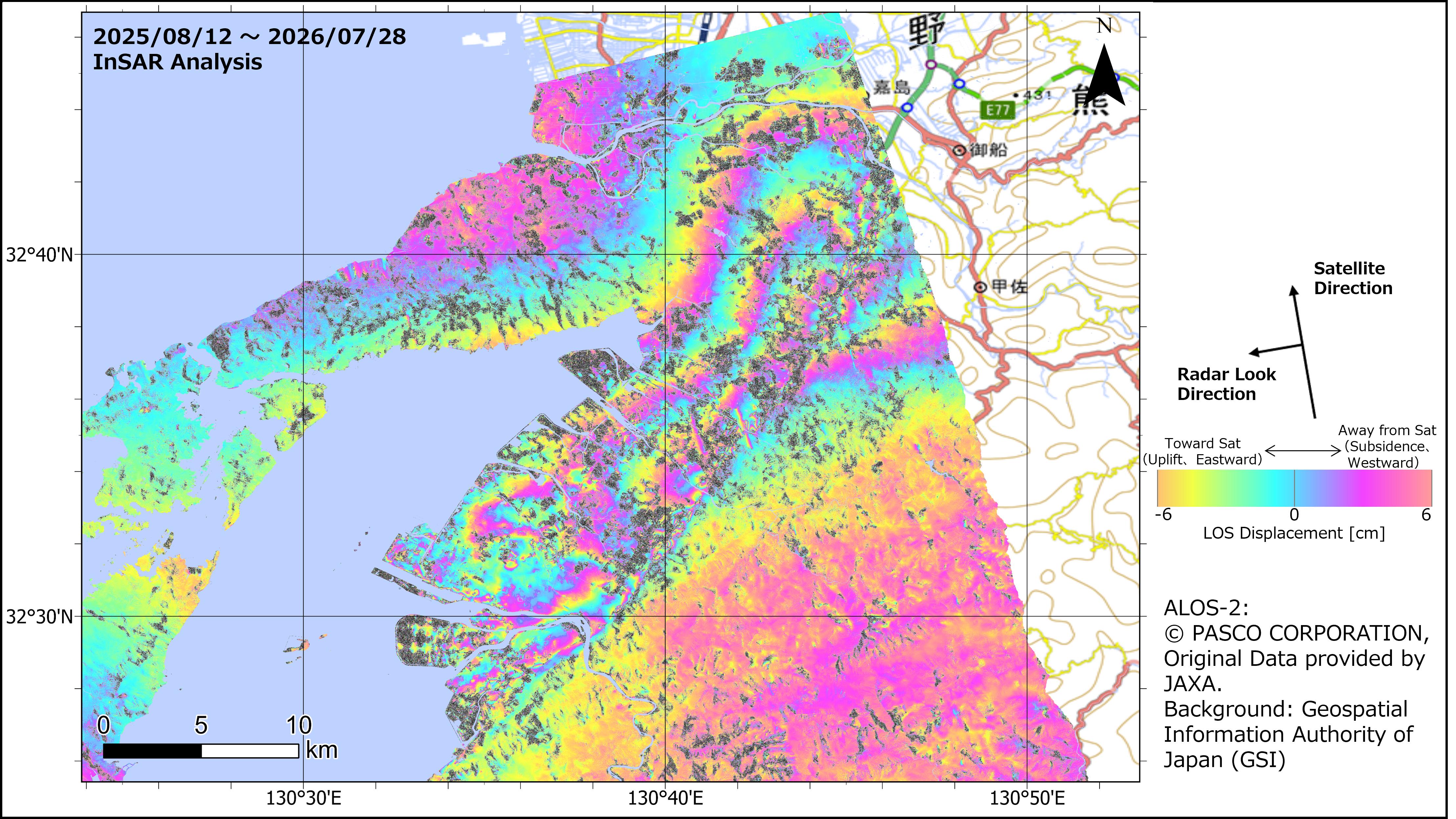
The InSAR analysis results indicate ground displacement associated with the earthquake. ※The accuracy of InSAR analysis is generally on the order of several centimeters. ※No ionospheric delay correction or tropospheric delay correction was applied.
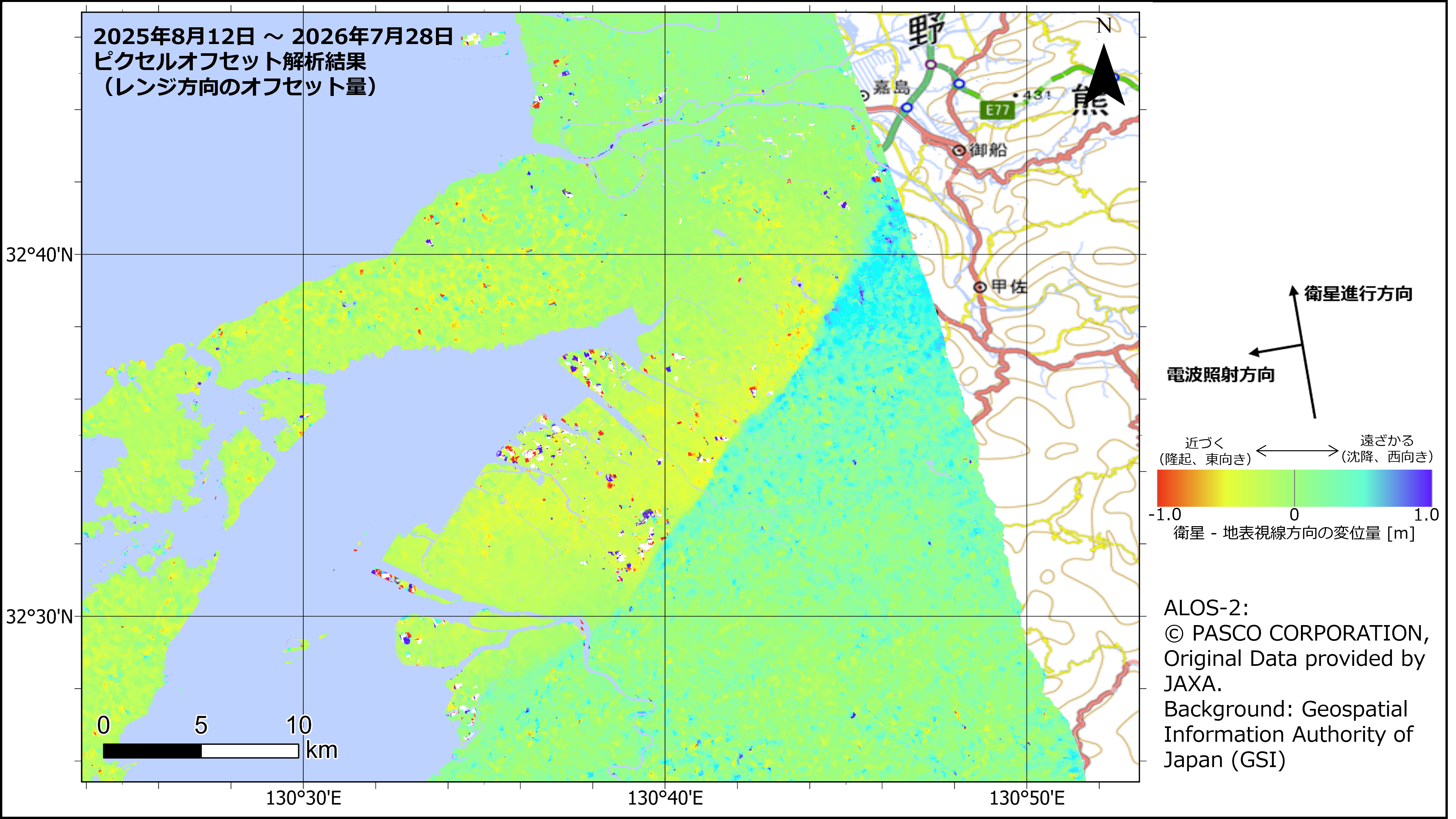 The pixel offset analysis results reveal displacement boundaries associated with the 2026 Kumamoto Earthquake.
■ ALOS-2 Observation Parameters Observation Dates: August 12, 2025; July 28, 2026 Observation Mode: StripMap 3 m (SM1) Resolution: 3 m Polarization: HH Observation Direction: Left-looking Orbit Direction: Ascending Scene IDs::(Pre-event) ALOS2605990680-250812, (Post-event) ALOS2657740680-260728 For inquiries regarding the imagery, please contact here.