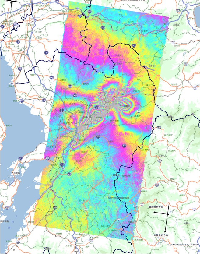
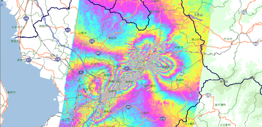
Interferometric Synthetic Aperture Radar Analysis (InSAR)
The “Interferometric Synthetic Aperture Radar (InSAR)” analysis is a technology for mapping ground deformation information such as subsidence and uplift of the ground surface that are collected by the radar satellite of multiple periods from the same orbit.
By using phase information, it is possible to grasp the displacement of millimeters (mm) to several centimeters (cm) , which is a unique technology of the radar satellite analysis.
Principle
Synthetic Aperture Radar (SAR) allows to obtain the “phase" of the backscattered portion of the microwave waves in addition to the intensity of backscattered waves from objects on the ground surface. By conducting two SAR observations of the same location on the Earth at different times from similar viewpoint and comparing against each other to make a difference, it is possible to use information on distance differences of several mm to several cm.
According to this principle of InSAR. we can observe crustal movements associated with land subsidence and natural disasters.
Utility
It is possible to measure the displacement of the ground surface (how much the ground moved) from the difference of observation data (backscattered wave information) over multi-temporal or more than two times (time series), observation periods.
This analysis method is particularly used in the fields such as ground change monitoring and estimation of urban changes. Image below shows the ground change estimated by InSAR analysis using the observation data before and after the 2016 Kumamoto earthquake disaster in Japan. We were able to confirm that the fluctuation occurred along the fault from the epicenter.