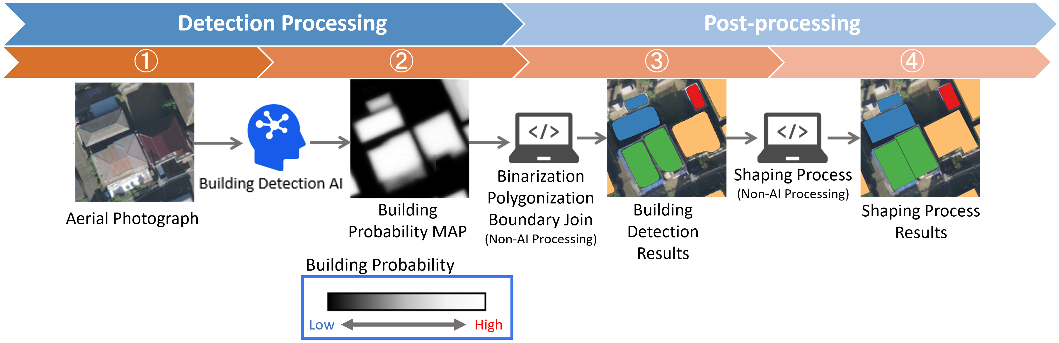
Building Detection
Overview
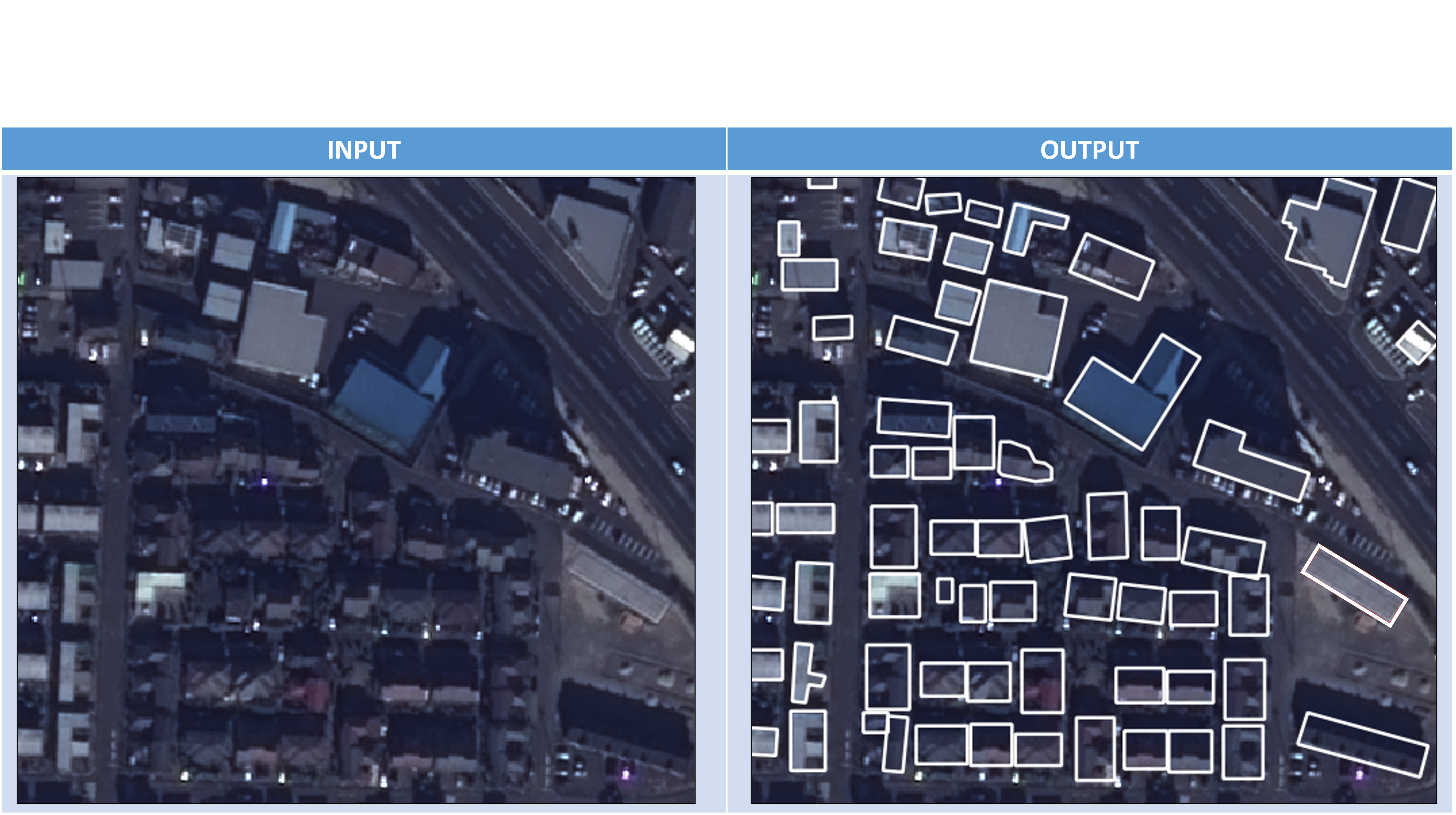
Extraction of building outline polygons
- Input aerial photos or satellite images from a single time period to a trained AI model
- The AI model judges the area that is considered to be a building from the image and outputs a confidence map (probability image) with a value of 0.0 to 1.0 for each pixel
- Binarization + polygonization by threshold for confidence map (probability image)
- By shaping the shape of the output polygon, it is finally output as a building polygon