Other
Other
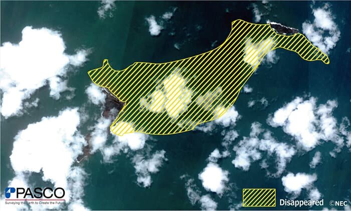
Underwater volcano Eruption near Tonga(Optical satellite Image)
On 15th January, 2022, a large-scale eruption was confirmed at the submarine volcano Hunga Tonga Hunga Ha'apai, located about 65 kilometers north of Nuku'alofa, the capital of Tonga.
The volcanic smoke is said to have spread up to 20,000 meters and a radius of 260 km.
Japan's earth observation optical satellite ASNARO-1 acquired images of the volcano and near the capital, Nuku'alofa.
Following image shows that most of the 285 hectares of volcanic islands may have disappeared.
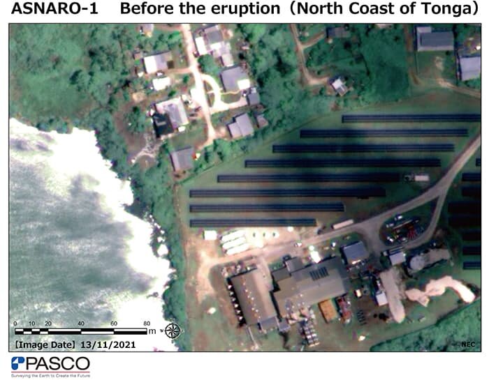
Accumulation of volcanic ash
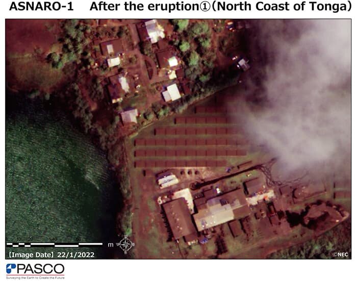
Comparing images of Tonga's coastal areas before and after the volcanic eruption, you can see that volcanic ash has accumulated mainly in the north. Below are images of the solar firm located in the northern coastal area and its surroundings.
In the image taken before the volcanic eruption, you can clearly see the color difference of solar panels, surrounding roads, and building roofs. On the other hand, in the image taken on January 22nd, one week after the eruption, volcanic ash has accumulated and the whole place has covered with volcanic ash.
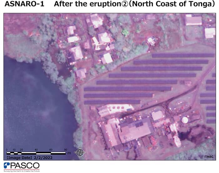
In the beginning of February, the volcanic ash on solar panels was mostly removed, indicating that the restoration is gradually progressing.
※These images in this article were taken by ASNARO-1 and processed for web display use.
※This is a case study article using satellite images with 50 cm resolution. ALOS-3 satellite images with a resolution of 80 cm are also expected to be used in similar fields.

